NebraskaTravels.com top Logo - click to return to Home Page

   
Scotts Bluff National Monument in Western Nebraska Panhandle
Western Nebraska Travel
- Via Scenic Highways off the Interstate through
the Nebraska Sandhills & Panhandle
(Large version of this Picture below)


The
Western Nebraska Travel Road Trip

- the Nebraska Sandhills  &  Panhandle Road Tour
Via the Scenic Non-Interstate Route


Nebraska Sandhills Via Scenic Highways
+ Scottsbluff Area Attractions +
Chadron Area - Niobrara River - Tallest Waterfall

Pictures, Info, Favorites, Tips

Page 1 - 21 large Western Nebraska Pictures below


NebraskaTravels.com
Home Page

New 2008 Viewing Tips - Sandhill Crane Migration Viewing Tips, Pictures & Video

Nebraska Maps
Interactive & Printable


Hover Button for
Drop-down List


To Social Bookmarks

Western Nebraska Panhandle Area
Northwest Nebraska Grasslands & Badlands Area
Nebraska Sandhills Area & Attractions

Sandhills Area Info
+ Attractions
& "Must See's *
* here soon

Northern Nebraska
Niobrara River

Niobrara River + Nearby Attractions *

Smith Falls Waterfall & Niobrara River Pict
+ Waterfall VideoNew

Sandhill Crane Viewing on Platte

New Sandhill Crane Migration - Viewing Tips, Pictures & Video

Eastern Nebraska Attractions
& "Must See's"

Lincoln, NE area Attractions
& "Must See's" *

10 Deer Running in Back Yard Video
+ Deer Fight

New Wild Turkeys in yard - Video & Pict

Indian Cave State Park near Brownville *

Picture Albums
+ High Resolution 
Photos

Nebraska Sunsets
Photo Gallery

+ free Screensaver Pict
 

Contact Us
- Your Comments
+ Site Map


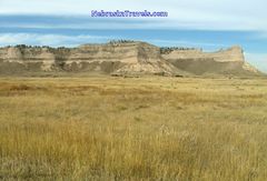
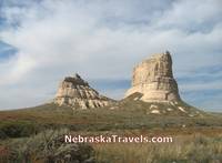
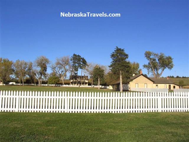
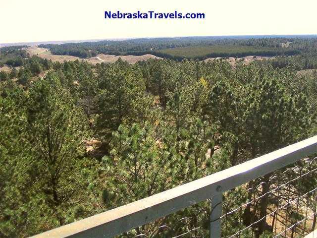
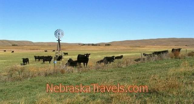
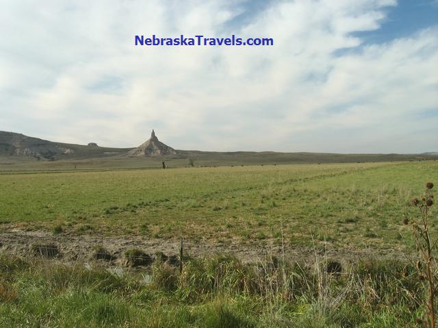
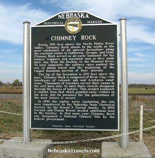
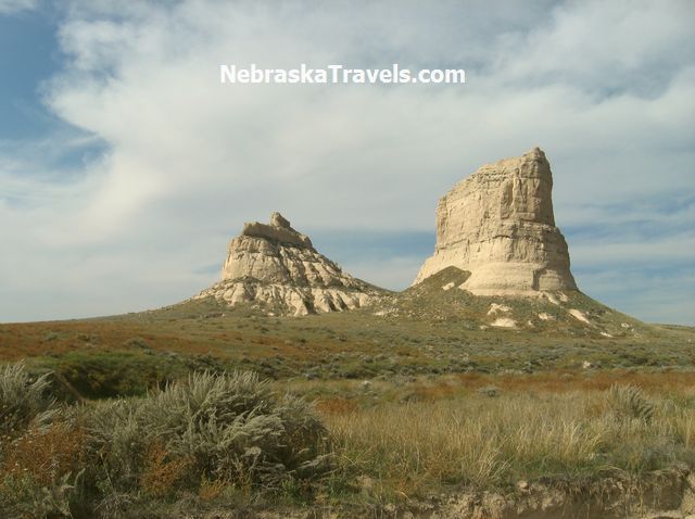
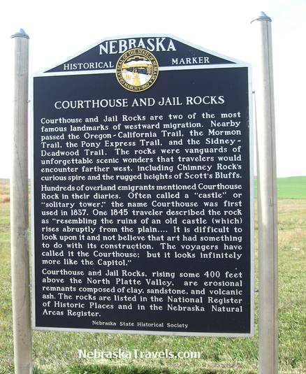
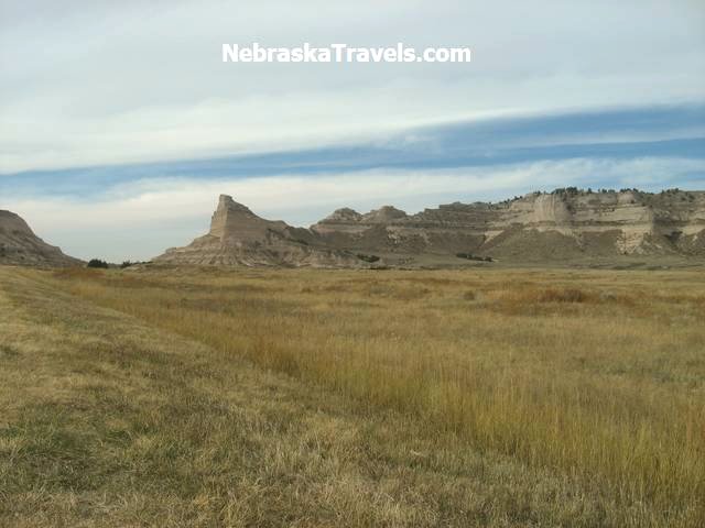
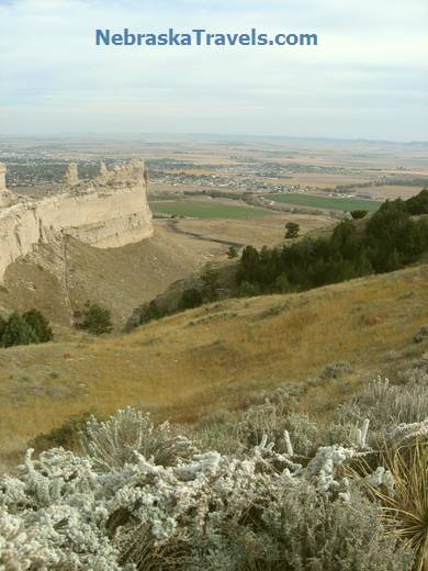
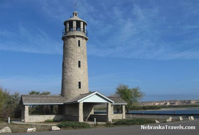
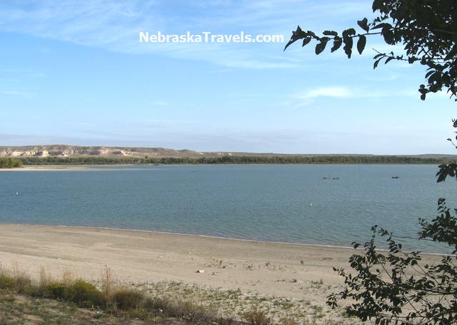
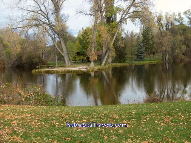
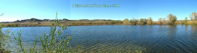
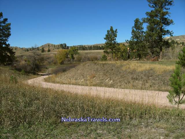
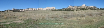
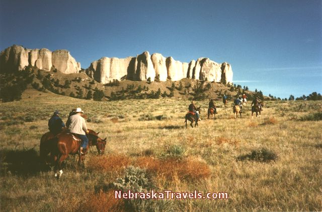
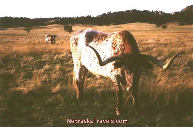
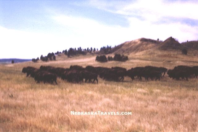
The large number of photos on this Western Nebraska Travel page may cause the page to load slow if on a dial-up connection. All Pictures here are copyrighted, but see below for free use instructions.

The images on this page are smaller file sizes to help them load faster - see bottom of page for some free larger file size Downloadable Wallpaper & Nebraska Sandhills Screensaver Versions -- also some high resolution printable Photo versions of US Vacation Points of Interest and Attractions with "comp" downloads.

 See details on the Links to other Pictures below from our Vacations to Western Nebraska & the Nebraska Sandhills + some other favorite affordable US Vacation areas and area Attraction Links Links below.


Pictures below are from a Road Trip Vacation to the Nebraska Sandhills & Western Nebraska - including Attractions in and near Scottsbluff & Chadron, Nebraska.


The Route Includes Chimney Rock, Courthouse and Jailhouse Rocks, Scotts Bluff National Monument, Halsey National Forest, Fort Robinson State Park, Toadstool Geologic Park Hiking Trail, Mari Sandoz Exhibit on CSC Campus, Niobrara River, and Smith Falls Tallest Waterfall in Nebraska Pictures, comments, "favorites," and Tips below -- including our "off the Interstate" checked out and recommended Scenic driving "loop" Route of Western Nebraska and the Sandhills described below.

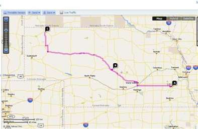
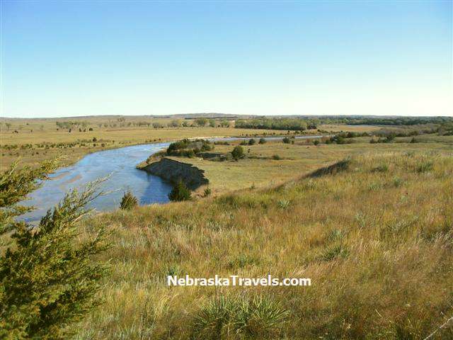
We took 8 days and 7 nights to do this driving trip and ran out of time toward the end where we had hoped to include the town of Niobrara and Ponca State Park. Next time we will allow more time -- there is a lot to see and do in Nebraska! We drove a little over 1,500 miles including all of the many side trips we took.


The pictures below are in the order of a "leisurely" Scenic Nebraska Driving Vacation we recently took from Lincoln, NE

Chimney Rock - on Oregon Trail east of Scottsbluff
Chimney Rock southeast of Scottsbluff
- Large picture version below

on our quest for more Western Nebraska Travels. It is a Road Trip Vacation "loop" which included the Scenic Route through the Nebraska Sandhills, Western Nebraska, the Nebraska Panhandle, The Nebraska Grasslands and Badlands, and following the Scenic Niobrara River.
  
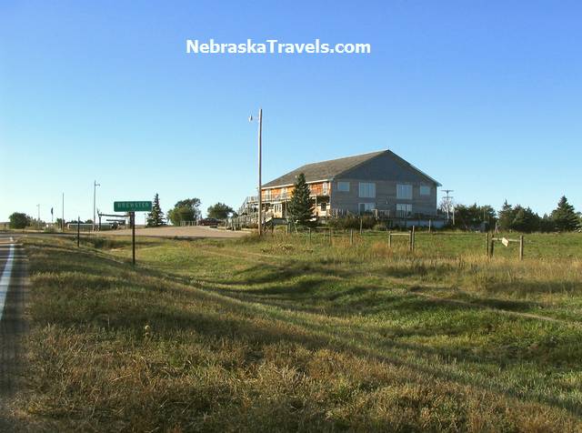
We tried to stay on Highways that were as Scenic as possible. Our driving route -- which included no Interstate driving -- started the "Scenic" Route portion in St. Paul, NE. It included the following Scenic or fairly Scenic Highways in this order from St Paul north of Grand Island: 11, 91, 2, 385, 92, 29, 20, 12, 281, 275, 14, and 39 to finish the "Scenic" part of the loop route near Clolumbus, NE.

We went through the towns of Burwell, Halsey, Alliance, Gering, Scottsbluff, Crawford, Chadron, Valentine, & O'Neill, and stayed overnight for one or more nights in or near the towns of: Brewster, Scottsbluff, Crawford, Chadron, and Springview. (We ran out of time to visit Niobrara State Park and Ponca State Park.)


Our Western Nebraska Vacation Travels - the Road Trip Areas
- the Nebraska Sandhills and Panhandle Road Tour Via the "Scenic Route"


Can check out pictures & comments in Vacation Travel driving order below
- or skip down to specific Nebraska Road Tour areas and Attractions

Click link to drop to Road Trip Area and Pictures below:

(This page got so many pictures on it that we are putting the 3 areas below on a seperate Page 2 of Western Nebraska and Sandhills Travel so it will load faster. - The Nebraska Area links below will go to the new page being built - check back.)


  • Chadron, Nebraska and Crawford, NE area Attractions - Including Fort Robinson State Park, Chadron State Park, Museum of Fur Trade, & others - on new page 2 being built.


  • Chadron Area and Northeast Nebraska Travel pages Now Here:

    -- Toadstool Geologic Park in the Chadron, NE "Badlands" area northwest of the Western Nebraska Sandhills -- plus Hiking Trail Info and Photo Gallery

    -- Mari Sandoz High Plains Heritage Center - prize-winning author - "Nebraska's Story Teller" - Exhibit on Chadron State College Campus in Chadron, NE

    -- Smith Falls Waterfall & Scenic Niobrara River - Tallest Waterfall in Nebraska + Waterfall Video and Smith Falls State Park Camping Info & Nebraska's Tallest Waterfall Pictures - a Nebraska Sandhills "Must See"


  • Scenic Hwy 20 through the northern Sandhills to Valentine, NE + More on the "Canoeable" Niobrara River + the Scenic Junction of the Niobrara and the Missouri Rivers - Coming on new page 2 - check back.

  • Colorful Nebraska Sunsets Photo Gallery + Nebraska Midwest Rural Country Sunrises & Free Screensaver or Wallpaper Pictures - with High Resolution Photo Download Links


Ord - Burwell - Brewster, Nebraska Via Scenic Highways 11 & 91
- Pictures and Comments

- Includes Fort Hartsuff Historic Park & Calamus Reservoir Recreation Area

Fort Hartsuff State Historical Park Buildings on edge of Nebrasks Sandhills near Burwell
Fort Hartsuff State Historical Park Buildings on edge of Nebraska Sandhills near Burwell, NE.

It was our first stop coming from Lincoln on our Western Nebraska Travels driving Vacation loop which included a Scenic Road Trip Route through the Nebraska Sandhills, Western Nebraska, the Nebraska Panhandle, The Nebraska Grasslands and Badlands, and following the Scenic Niobrara River.


Their were many displays of Antiques in the setting they would have been used at Fort Hartsuff State Historical Park Antiques on edge of Nebrasks Sandhills near Burwell
Their were many displays of Antiques in the setting they would have been used at Fort Hartsuff State Historical Park. There was a large display of antique guns.
The Fort is near Burwell, NE on the edge of the Western Nebraska Sandhills

To the Nebraska Game and Parks Commission page on Fort Hartsuff State Park - even a Video Tour!

Calamus Reservoir Picnic Area + view of the Dam - near Burwell in Nebraska Sandhills
Calamus Reservoir day use Area + view of the Dam - near Burwell, NE in Western Nebraska Sandhills


Calamus Reservoir Sand Beach Area + view of the Dam - near Burwell in Nebraska Sandhills
Calamus Reservoir Sand Beach Area + view of the Dam - near Burwell in Western Nebraska Sandhills

To more Info on Calamus Reservoir and Calamus State Recreation area on Nebraska Game and Parks Commission Web Site

All pictures on this page are Copyrighted but you are welcome to download and use them if
the Watermark text remains visible on the image as it is here - see bottom of page for other free
downloads + High Resolution US Vacation Photo links  
(A couple of Photos on this page are on another Site by permission)


North Loup River and the Nebraska National Forest at Halsey
+ Scenic Highway 2 through the Nebraska Sandhills


- with many Windmills and much prime Sandhills Grassland


North Loup River and Grasslands in Western Nebraska Sandhills
North Loup River winds through the Grasslands in Western Nebraska Sandhills near Brewster, NE.

(A Picture similiar to one above + the Photo below are now available in high resolution
downloadable versions - see
Link below.)


North Loup River winds through the Grasslands in Western Nebraska Sandhills near Brewster, NE
Peaceful North Loup River "meanders" through the Grasslands in the Western Nebraska Sandhills
east of Halsey Nebraska National Forest.

This link goes to a Map of the Nebraska Sandhills region which also shows the locations of the
three larger Nebraska National Forest areas.


Uncle Bucks Lodge in Western Nebraska Sandhills in Brewster, NE
Uncle Bucks Lodge in Western Nebraska Sandhills in Brewster, NE. Seemed like a big facility for such a remote area, but we understand it is used for many weddings and dances + many hunters stay there during seasons. There was only one other couple there the night we stayed there in mid October - which is off season. The big north windows provide a view of the Scenic North Loup River.


Uncle Bucks Lodge Wooden Barstools in Western Nebraska Sandhills near Brewster
Interesting Uncle Bucks Lodge Wooden Barstools - Western Nebraska Sandhills near North Loup River


Halsey Nebraska National Forest Fire Lookout Tower - Nebraska Sandhills Travels
Halsey Nebraska National Forest Fire Lookout Tower. It was a bit of a climb on the noisy metal stairs, but a great view from the top.


Halsey Nebraska National Forest from top of Fire Lookout Tower
Halsey Nebraska National Forest from top of the Fire Lookout Tower. This is an entirely "Man Planted" forest which you can read more about at the Web Site link below. You can see a "fire band" clearcut area of the forest which is done to stop the spread of a forest fire.

This link goes to a US Department of Agriculture Web Site with Information on all of the Nebraska National Forest areas + the Oglala National Grasslands with links and pictures.
Click on the small Western Nebraska map to the see a larger version showing all of the locations
in Nebraska - click a second time to enlarge the map more.


Fire Lookout Tower stairs down from top - Halsey Nebraska National Forest
Fire Lookout Tower stairs down from top - Halsey Nebraska National Forest. It was kind of windy
at the top that day, so we were glad to get back down to the ground again.


Western Nebraska Sandhills + Wooden Windmill - Cattle grazing on Grasslands
Western Nebraska Sandhills Grasslands + a short wooden Windmill - great pasture land for Cattle Grazing.

(A picture similiar to one above + the Chimney and Courthouse Rocks pictures below are now available
in High Resolution Downloadable Versions
- see Link below.)


You see many short windmills - many old wooden ones Vs metal. Don't need to be high in the air to catch enough wind to pump water for a cattle stock tank. Curious stock cattle often come up to the fence when you get out of your car to take a picture. You can see that most of the cattle are looking at me taking this picture -- and I didn't even have to say "cheese!"


Scottsbluff area Attractions - including Chimney Rock and
Scotts Bluff National Monument

+ Lake Minatare Lighthouse, Agate Fossil Beds and Jailhouse / Courthouse Rocks


Chimney Rock from about a mile away - In Western Nebraska Panhandle east of Scottsbluff
Chimney Rock from about a mile away. On Oregon Trail in Western Nebraska Panhandle east of Scottsbluff.
The spire of Chimney Rock was measured as being approximately 500 feet above the river
in about 1900. It is estimated that Chimney Rock has lost about 30 feet of height
due to weather and lightning hits during the last 100+ years.


Chimney Rock on Oregon Trail - In Western Nebraska Panhandle east of Scottsbluff
Popular Chimney Rock Attraction on Oregon Trail - In Western Nebraska Panhandle
east of Scottsbluff off of Hwy 92 - Southwest of the edge of the Sandhills (see map link below)

(Chimney Rock Picture above + the Courthouse Rock and Scotts Bluff Monumient pictures below are now available
in High Resolution Downloadable Versions
- see Link below.)


Chimney Rock Historical Marker - east of Scottsbluff on Hwy 92
Chimney Rock Historical Marker - East of Scottsbluff on Hwy 92


To Chimney Rock National Historic Site Web Site Pages on the Nebraska Historical Society Web Site
- Scroll down for Visitor Center Times and Info.


Courthouse and Jailhouse Rock - On Oregon Trail East of Scottsbluff, NE
Courthouse and Jailhouse Rock on Oregon Trail - East of Scottsbluff near Bridgeport off of Hwy 92.
In the Western Nebraska Panhandle southwest of the edge of the Nebraska Sandhills

This link is to a Detailed Nebraska Sandhills Region Map which shows a small
detached Sandhills area near Courthouse & Jailhouse Rocks + several aerial Sandhills Photos


Courthousee and Jailhouse Rock Historical Marker next to Hwy 92 east of Scottsbluff
Courthouse and Jailhouse Rocks Historical Marker - on Hwy 92 east of Scottsbluff near Bridgeport, NE.

Or - see this page on the Bridgport, NE Web Site for more Information and
one picture of Courthouse and Jailhouse Rocks.


Approaching Scotts Bluff National Monument from the east on Hwy 92 west of Gering
Approaching Scotts Bluff National Monument from the east on Hwy 92 west of Gering.
(A photo similar to one above is available in High Resolution - see
Link below)

All pictures on this page are Copyrighted - see below for free use instructions & downloadable files


Approaching Scotts Bluff National Monument from the east on Hwy 92 west of Gering, Nebraska
Looking down from top of Scotts Bluff National Monument to the southeast toward Gering, NE.

You can see much Scotts Bluff National Monument Information + several Pictures on these pages
on the National Park Service Web Site.
Tip - Click the "Plan your Visit" Link for a Driving Road and Hicking trails Map.


Lake Minatare Lighthouse near Scottsbluff in Western Nebraska
Historic Lake Minatare Lighthouse in Lake Minatare State Recreation Area & Park - near Scottsbluff in Western Nebraska. One of 2 lighthouses in Nebraska. Built by the Veterans Conservation Corps in 1939.
Has never had a light. Can climb circular steps to top for great view.

(A picture similiar to one above is now available in High Resolution Downloadable Versions - see Link below.)


Lake Minatare State Recreation Area near Scottsbluff in Western Nebraska
Lake Minatare State Recreation Area. Beautiful scenic park and large fishing lake with many campsites.
Can see interesting rock formations in background


See more Info on the Lake Minatare State Recreation Area and Lighthouse on this Nebraska Game and Parks Commission Web Site page - includes a video tour.


Western Nebraska Travel Areas Being Built and Built:
  • Chadron, Nebraska and Crawford, NE area Attractions - Including Fort Robinson State Park, Chadron State Park, Museum of Fur Trade, & others - on new page 2 being built.


  • Chadron Area and Northeast Nebraska Travel pages Now Here:

    -- Toadstool Geologic Park in the Chadron, NE "Badlands" area northwest of the Western Nebraska Sandhills -- plus Hiking Trail Info and Photo Gallery

    -- Mari Sandoz High Plains Heritage Center - prize-winning author - "Nebraska's Story Teller" - Exhibit on Chadron State College Campus in Chadron, NE

    -- Smith Falls Waterfall & Scenic Niobrara River - Tallest Waterfall in Nebraska + Waterfall Video and Smith Falls State Park Camping Info & Nebraska's Tallest Waterfall Pictures - a Nebraska Sandhills "Must See"


  • Scenic Hwy 20 through the northern Sandhills to Valentine, NE + More on the "Canoeable" Niobrara River + the Scenic Junction of the Niobrara and the Missouri Rivers - Coming on new page 2 - check back

  • Colorful Nebraska Sunsets Photo Gallery + Nebraska Midwest Rural Country Sunrises & Free Screensaver or Wallpaper Pictures - with High Resolution Photo Download Links


All pictures on this page are Copyrighted but you are welcome to download and use them if
the Watermark text remains visible on the image as it is here - see below for other free
downloads + High Resolution Beach Photo links


The list of the pages on this Site now with descriptions and links is below.


"Tips to help you Plan & Save + Pictures to help you Dream"


All Western Nebraska Travel Road Trip & Attraction pictures on this page are Copyrighted but you are welcome to download and use them if the Watermark text remains visible on the image as it is here - Also see High Resolution Downloadable Photos link above. (Some Photos on this page are on another Site by permission)


Gene - Contact Us - send your comments or suggestions -- or share your own Western Nebraska Travel + Scottsbluff NE and Nebraska Sandhills or Panhandle favorites or pictures. We appreciate your comments and feedback!


To Home Page - NebraskaTravels.com - Nebraska road trips with special sections on the Nebraska Sandhills - An "Insider" Nebraska Vacations Guide - "Reviews" - Tips - Pictures


Looking for something specific? Search our 3 US Vacation Guide Sites.


Google


To Top of this Page - Western Nebraska Travel To Top of this Page - Western Nebraska Travel Road Trip - the Nebraska Sandhills and Panhandle Road Tour Vacation - Pictures, Favorites, Comments, and Tips.


Copyright © 2006 - 2008    GoUSVacations.com Sites: NebraskaTravels.com   •  All rights reserved